LiDAR Collection — Overview
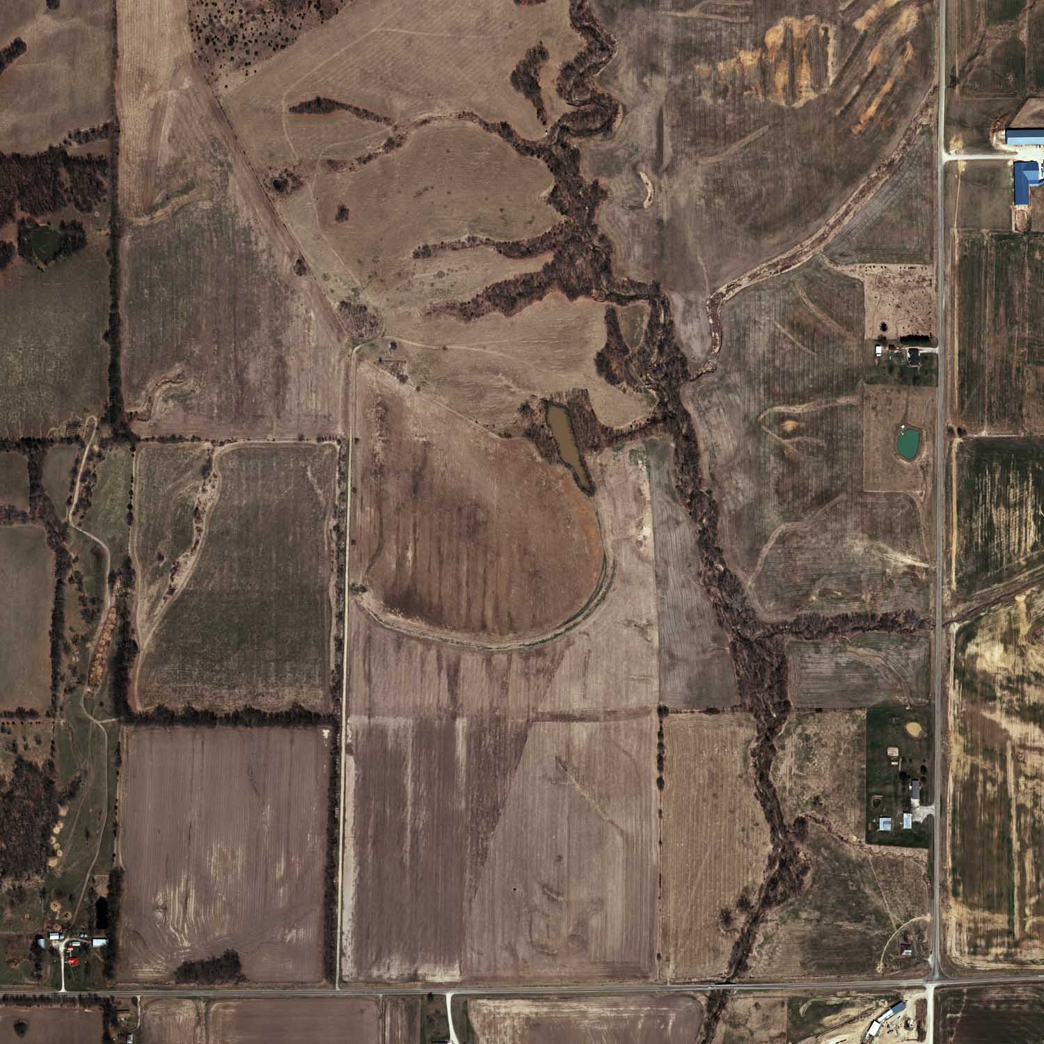
Light Detection and Ranging (LiDAR) has revolutionized the acquisition of digital elevation data for all scales of mapping applications. Williams Aerial & Mapping, Inc. was the first in the region to acquire a Trimble Harrier 68i in order to provide superb elevation and image coverage for your projects. Examples would include power line corridors, highway mapping, quarry updates and volumetrics, along with many other applications.
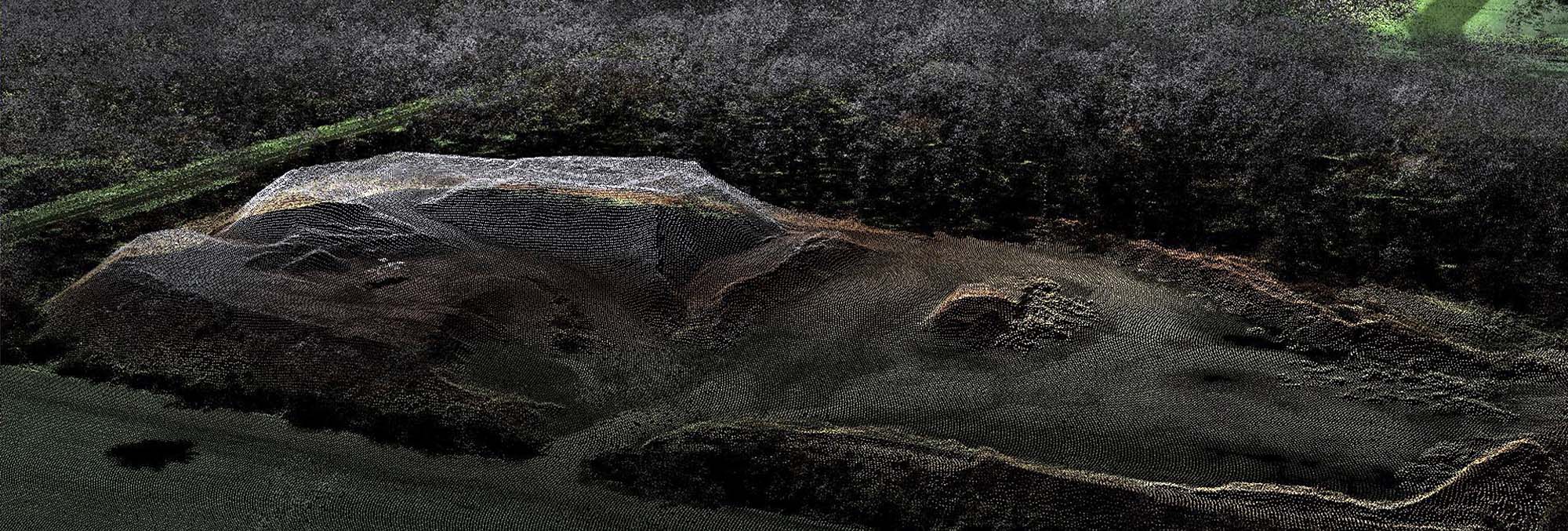
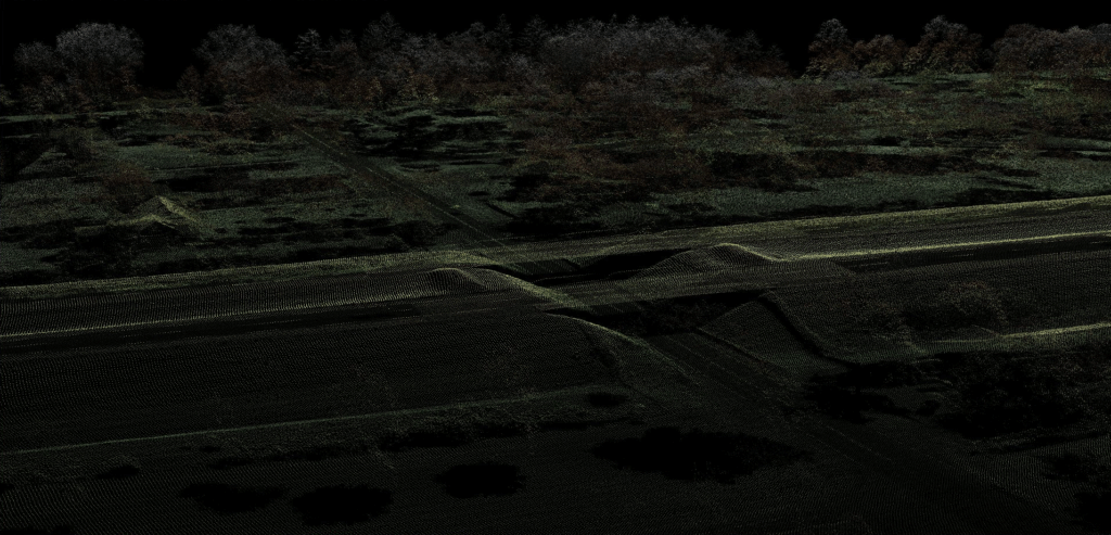
Here at Williams, we have an extensive background with LiDAR collection and production.
Our pilots are highly trained for the process of LiDAR point collection and have tens of thousands of hours of collection since 2014. We have experience collecting data for highway corridors, pipeline projects, power-line mapping and wide area mapping jobs.
Our slow flight aircraft equipped with the canard wing allows us to collect lidar comparable to helicopters at a quarter of the cost.
Our processing team is equally experienced as well. We pride ourselves in processing the data for your job in house with a highly trained and skilled team. With a total of over 60 years of photogrammetry background, our team will develop a solution to fit any requirements for your project.
Photogrammetric Mapping
Whether you have a corridor project or annual stockpile updates, our experienced staff has the skill to ensure your job is completed with the highest levels of accuracy. The images on this website are just a few examples of the quality we are capable of producing.
What is Photogrammetric Mapping?
The two major features of Photogrammetric Mapping are Planimetric and Topographic Mapping. Planimetric Mapping includes and identifies physical features such as roads, buildings, and vegetation, while Topographic Mapping is a collection of break lines and spot elevations. This method of mapping is a primary source for the creation of Digital Elevation Models (DEMs) and Digital Terrain Models (DTMs). Williams Aerial & Mapping, Inc. has over 60 years of experience creating both planimetric and topographic maps.
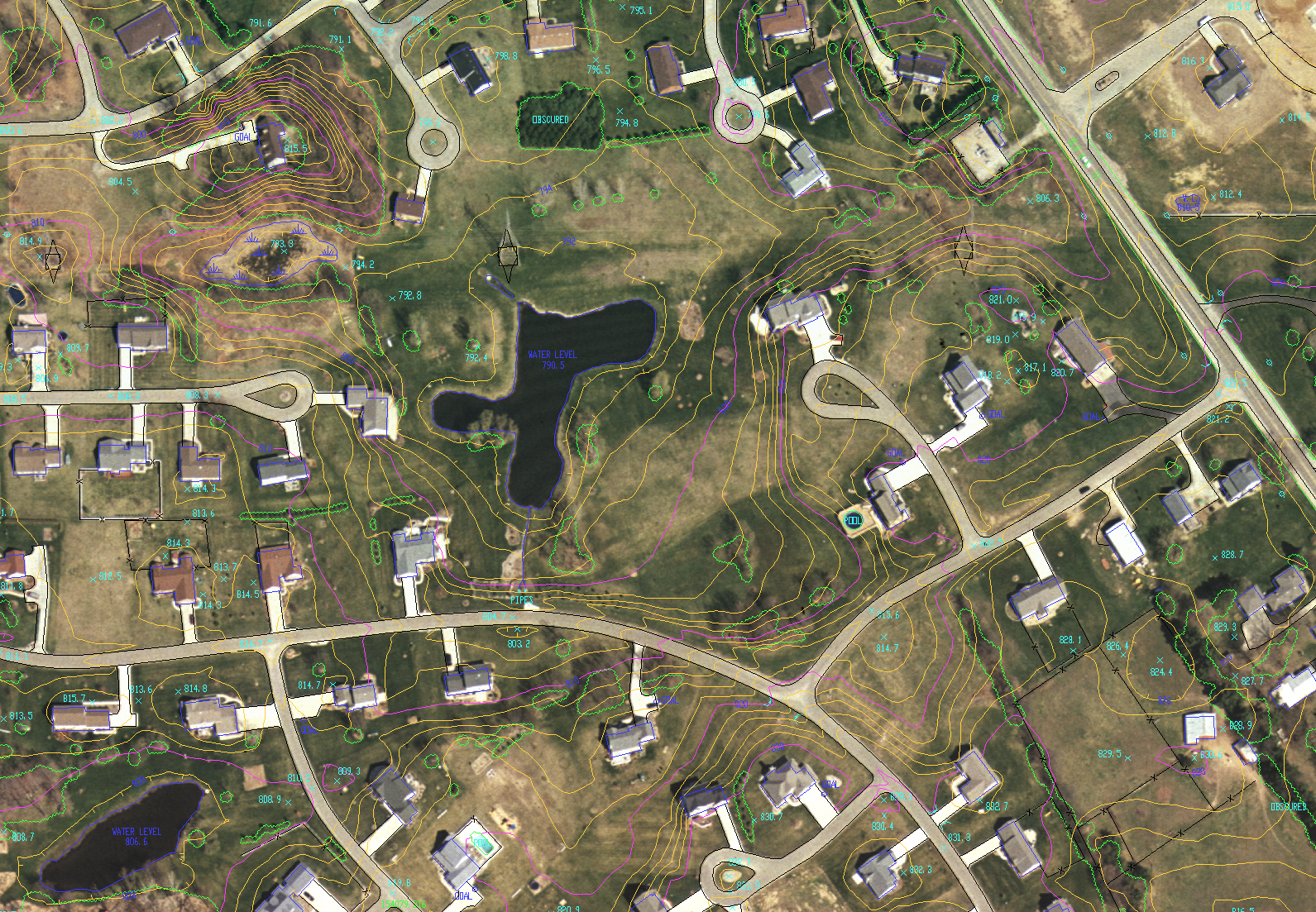
We use a variety of analytic techniques to create topographic and planimetric maps. Some common applications for planimetric mapping include: GIS base maps, Digital Elevation Models, road design, drainage and runoff analysis, volume determination of sand, coal, and mines, landfill compaction ratios and subdivision design.
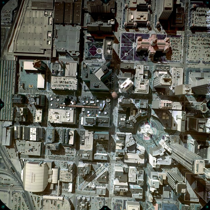
Orthophotography
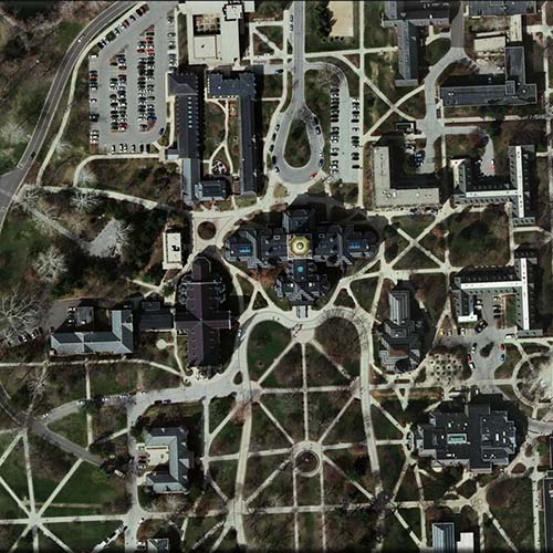
Our orthophotography is unsurpassed in image quality. All projects are mosaicked, even with multiple flight scales, resulting in truly seamless imagery. Whether you have a corridor project or annual stockpile updates, our experienced staff has the skill to ensure your job is done with extreme levels of accuracy.
Some common applications for orthophotography are Base Maps for GIS, Urban planning, Watershed analysis, Civil engineering and Environmental Assessment.
Aerial Photographs inherently contain distortions as a result of factors such as, the sensor’s orientation at exposure, surface relief and lens distortion. In an orthophotograph, these distortions have been removed.
Key benefits and applications of these maps are that they are easily interpreted, they allow direct measurements of distances, areas and angles, and that more features are shown than what are practical to capture on a vector map.
What is Orthophotography?
Williams Aerial & Mapping, Inc. has produced orthophotography for various types of engineering firms with projects ranging from, but not limited to, quarries, nuclear sites, corridors, as well as more than a quarter of Indiana’s counties. All orthophotography’s are produced in-house at our headquarters in South Bend, Indiana. We have delivered quality orthophotography with pixel resolutions ranging from a quarter inch to two feet.
Orthophotography is commonly used as base maps in the Geographic Information System (GIS). These maps are compiled with the collection of aerial photographs, which are oriented through trigonometric processes and then molded to the ground elevation data you prefer. After this process is complete, the final product is what is known as an Orthorectified Base Map.